Is A New Sinkhole Forming Nearby? N.W. of Lake FUBAR
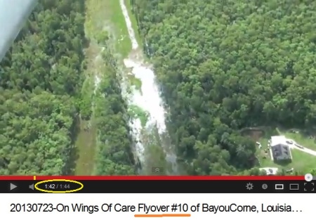
Did the new video from On Wings of Care, Bayou Corne Fly Over #10, capture a new sinkhole starting up?
Look at this screen shot -
CLICK ON IMAGE FOR FULL SIZE
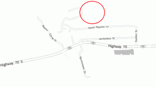
MAP -
Map is from Yahoo. Source. Streets names:
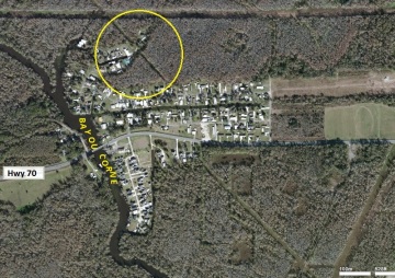
This spot is NORTH of Hwy 70 to the west of Lake FUBAR.
Maybe it’s naturally watery at times – shows here in the newer bubble site map.
Weekend News
Scroll down for the seismic activity updates.
DNR has a new Inspection Report dated July 25th.
DOTD has added a lot of new monitors for Highway 70 and they specify them in a July 16th Power Point file shown on this page. If you can’t view a Power Point file you can download this viewer (free). Texas Brine is supposed to be reimbursing all of the costs to DOTD. Have they paid a penny? Is anyone making them?
GOHSEP hasn’t put out a Situation Summary in over 10 days.
The Heath Dept. has no 2013 updates at all. That makes sense since they haven’t done anything all year.
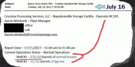
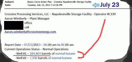
Crosstex is STILL adding butane to their cavern a hair away from Lake FUBAR! They added 19,284 barrels of butane from July 15 to July 22.
El Barfo Reloads
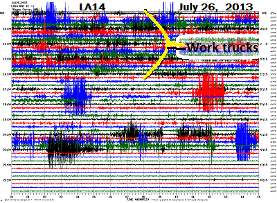
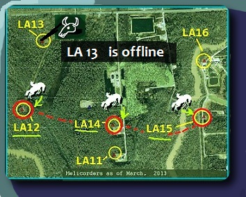
Reader, Baymuse points out last night, after the work trucks were done (making solid shake lines on the helicorders) there were several big eventsunder Lake FUBAR. They showed on LA11-14 most.
Here’s what LA14 looked like Friday night:
Here’s what LA14 looked like Friday night:
And helicorder watcher, Darrell Goad recorded it -
LINK - http://youtu.be/9EI9XtD9mEA
and TODAY:
LINK - http://youtu.be/vOJCqo9MW6s
10:30 a.m. CST - Hold On!
Sonny, Sonny, Sonny . . .
A lot has happened since our last open-letter, “Dear Sonny Cranch,” on July 7th. Back on July 15th, the Associated Press had this: Official: Bayou Corne sinkhole at least 500 feet deep
BAYOU CORNE — An official says the deepest part of the 22-acre sinkhole near Bayou Corne is at least 500 feet deep, and not between 110 to 220 feet deep that has been estimated by Texas Brine.
John Boudreaux, director of the Assumption Parish Office of Homeland Security, tells The Advocate previous depth reports released by Texas Brine Co. may have been inaccurate because the company’s sonar did not penetrate debris fields inside the sinkhole. . . .
. . . . Texas Brine spokesman Sonny Cranch said Sunday he is confident the company’s depth findings are correct. A Texas Brine contractor has said the sinkhole is from 110 feet to 220 feet deep, according to previous monthly depth-finding surveys. . . .
. . . . Boudreaux said he did not use a sophisticated method like sonar to measure the sinkhole. Instead, he said, he took a 10-pound crowbar with the ends cut off and attached it to a 500-foot surveyor’s tape measure, drove out to the center of the sinkhole in an amphibious vehicle and let the crowbar go, unspooling the tape measure until it could not go any further. . . .
The Parish put out this popular video on July 20th. It shows 750′ of line unspooling without hitting bottom. When the video was released and seen by over ten thousand people you and Texas Brine had nothing to say in response.
LINK – http://youtu.be/Gfud_j756A8
According to the July 11 “Fact” sheet from Texas Brine your vertical seismic profiling and 3-D mapping are just great. And Texas Brine claims
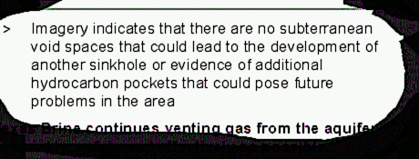
- there’s NO chance of another sinkhole forming under Lake FUBAR
- there are NO pockets of hydrocarbons down there
- and NO void spaces in there
How can Texas Brine claim THAT when they don’t even know how deep Lake FUBAR is????
New Fly Over Video – Wednesday News
Scroll down for news about the latest blow-out in the Gulf of Mexico.
On Wings of Care has a new, #10, Bayou Corne fly over up -
LINK - http://youtu.be/brbqsqzHB2g
