Commentary on the economic , geopolitical and simply fascinating things going on. Served occasionally with a side of snark.
Friday, March 14, 2014
Malaysian Airline Flight 370 mystery updates March 14 , 2014 -- Even as Transport Minister Hussein gives another press statement , questions abound regarding th track of the missing plane . Search area now include indian Ocean. Was the plane being taken to the Middle East or Europe and why ? A few key points to consider -- The fact that the aircraft – if it was MH370 – had lost contact with air traffic control and was invisible to civilian radar suggested someone on board had turned its communication systems off, the first two sources said. In addition , new details were given on the direction in which the unidentified aircraft was heading – following aviation corridors identified on maps used by pilots as N571 and P628. These routes are taken by commercial planes flying from south-east Asia to the Middle East or Europe and can be found in public documents issued by regional aviation authorities . As a result , Malaysia was requesting raw radar data from its neighbours Thailand, Indonesia and India, which has a naval base in the Andaman Islands.
We’re going to wrap up our live blog coverage for the day. Here’s a summary of where things stand:
• No tangible clue to the fate of Malaysia Airlines flight 370 had emerged after a week of searching. The plane disappeared north of Kuala Lumpur in the early hours of 8 March with 239 people aboard.
• US ships, helicopters and surveillance aircraft expanded a search on the Indian Ocean side of Malaysia. India sent flights with heat sensors over the remote Andaman Sea islands. “We just have to take it little by little,” a US Navy commander said.
• Flight 370 made significant changes in altitude and took more than one turn after losing contact with ground control, in a pattern that suggests someone was flying it, the New York Times reported, quoting “American officials and others familiar with the investigation.”
• The Indian Ocean search intensified, an Obama administration official said Thursday, based on radar readings and automated transmissions from the plane that registered on a satellite network.
• A satellite company said its network had picked up “routine, automated signals” from the plane, but executives would not say for how long. Such pings are only received when the normal data transmission is not operating, once per hour, the company, Inmarsat,told the Guardian.
and....
Missing Malaysian Flight: Hijacking, Sabotage Theories Added To The Mix
Submitted by Tyler Durden on 03/14/2014 07:58 -0400
Until today, the prevailing theory surrounding the mysterious disappearance of Malaysia Airlines flight MH370 was either catastrophic midair disintegration and/or terrorism. That changed overnight, following reports by various news agencies that the Boeing 777 was deliberately flown hundreds of miles off course, in a westerly direction toward India's Andaman islands, heightening suspicions of foul play among investigators, as reported by Reuters. And like that the theory shifts from one of terrorism to hijacking and sabotage, ostensibly by highly skilled operators, yet considering the results, one gone horribly wrong.
Analysis of the Malaysia data suggests the plane, with 239 people on board, diverted from its intended northeast route from Kuala Lumpur to Beijing and flew west instead, using airline flight corridors normally employed for routes to the Middle East and Europe, said sources familiar with investigations into the Boeing 777's disappearance. Two sources said an unidentified aircraft that investigators believe was Flight MH370 was following a route between navigational waypoints when it was last plotted on military radar off the country's northwest coast.
This indicates that it was either being flown by the pilots or someone with knowledge of those waypoints, the sources said.
The last plot on the military radar's tracking suggested the plane was flying toward India's Andaman Islands, a chain of isles between the Andaman Sea and the Bay of Bengal, they said.
A third source familiar with the investigation said inquiries were focusing increasingly on the theory that someone who knew how to fly a plane deliberately diverted the flight.
While the western direction is a recent hypothesis, the reality is that searching for the plane so far has been the equivalent of finding the needle in the proverbial haystack, as shown in the map below which plots the potential area where MH370 could have gone:
A summary timeline of the progression in the MH370 theories:
Regardless of the plane's final resting place, the key change is that in addition to possible terrorism, the prevailing theory is shifting to one involving hijacking:
"What we can say is we are looking at sabotage, with hijack still on the cards," said that source, a senior Malaysian police official.
All three sources declined to be identified because they were not authorized to speak to the media and due to the sensitivity of the investigation.
Officials at Malaysia's Ministry of Transport, the official point of contact for information on the investigation, did not return calls seeking comment.
Malaysian police have previously said they were investigating whether any passengers or crew had personal or psychological problems that might shed light on the mystery, along with the possibility of a hijacking, sabotage or mechanical failure.
As a result of the new evidence, the sources said, multinational search efforts were being stepped up in the Andaman Sea and also the Indian Ocean.
But if it was indeed a hijacking, who was the perpetrator? And what was the ultimate destination? Question which will hopefully be answered soon. In the meantime, the search for the missing flight continues:
In one of the most baffling mysteries in modern aviation, no trace of the plane nor any sign of wreckage has been found despite a search by the navies and military aircraft of more than a dozen countries. The last sighting of the aircraft on civilian radar screens came shortly before 1:30 a.m. Malaysian time last Saturday (1730 GMT Friday), less than an hour after it took off from Kuala Lumpur, as the plane flew northeast across the mouth of the Gulf of Thailand. That put the plane on Malaysia's east coast.
Malaysia's air force chief said on Wednesday an aircraft that could have been the missing plane was plotted on military radar at 2:15 a.m., 200 miles northwest of Penang Island off Malaysia's west coast. This position marks the limit of Malaysia's military radar in that part of the country, a fourth source familiar with the investigation told Reuters.
When asked about the range of military radar at a news conference on Thursday, Malaysian Transport Minister Hishammuddin Hussein said it was "a sensitive issue" that he was not going to reveal.
"Even if it doesn't extend beyond that, we can get the co-operation of the neighboring countries," he said.
The fact that the aircraft - if it was MH370 - had lost contact with air traffic control and was invisible to civilian radar suggested someone on board had turned off its communication systems, the first two sources said.
They also gave new details on the direction in which the unidentified aircraft was heading - following aviation corridors identified on maps used by pilots as N571 and P628. These routes are taken by commercial planes flying from Southeast Asia to the Middle East or Europe and can be found in public documents issued by regional aviation authorities.
In a far more detailed description of the military radar plotting than has been publicly revealed, the first two sources said the last confirmed position of MH370 was at 35,000 feet about 90 miles off the east coast of Malaysia, heading towards Vietnam, near a navigational waypoint called "Igari". The time was 1:21 a.m..
The military track suggests it then turned sharply westwards, heading towards a waypoint called "Vampi", northeast of Indonesia's Aceh province and a navigational point used for planes following route N571 to the Middle East. From there, the plot indicates the plane flew towards a waypoint called "Gival", south of the Thai island of Phuket, and was last plotted heading northwest towards another waypoint called "Igrex", on route P628 that would take it over the Andaman Islands and which carriers use to fly towards Europe.
The only other question is how this too airplane "crisis" will not be put to waste by US authorities, and the FSA...
We are now entering the seventh day of the search for MH370. There are currently 57 ships and 48 aircraft in the search. Thirteen countries are now involved.
Our priority remains finding the plane. We are following all leads, and we continue to work closely with our international partners. We are grateful for the support of our friends and neighbours, who continue to assist us by sharing their data and their resources as we search for MH370. I speak for the Malaysian people when I say that our hearts are with the families and the friends of those on board the plane.
New information
There has been a lot of media speculation today after comments from unnamed US officials suggested the plane may have travelled for some time after losing contact.
As is standard procedure, the investigation team will not publicly release information until it has been properly verified and corroborated with the relevant authorities. Nor do we want to be drawn into specific remarks that unnamed officials have reportedly made the media.
Since Sunday, we have worked closely with our international partners, including the US team, whose officials have been here on the ground in Kuala Lumpur.
Since Wednesday, the Malaysian investigating team have shared more detailed information, as it became available, for verification.
The international team are currently working on verifying that detailed information, but we have nothing to confirm at the moment.
Widening of the investigation
The aircraft is still missing, and the search area is expanding. Two days ago, the search area was widened to include the Andaman Sea.
Together with our international partners, we are now pushing further east into the South China Sea, and further into the Indian Ocean.
We want nothing more than to find the plane as quickly as possible. But the circumstances have forced us to widen our search.
A normal investigation becomes narrower with time, as new information focuses the search. But this is not a normal investigation. In this case, the information we have forces us to look further and further afield.
Engine data
Yesterday, we rejected a media report in which unnamed officials said that engine data showed the plane had kept flying for hours after last contact. We checked with Boeing and Rolls Royce, who said the reports were not true. Today Rolls Royce released a statement saying, and I quote, ‘Rolls Royce continues to provide its full support to the authorities and Malaysia Airlines. Rolls Royce concurs with the statement made on Thursday 13th March by Malaysia’s Transport Minister regarding engine health monitoring data received from the aircraft’.
Oil slick
Yesterday authorities sighted two oil slicks in the South China Sea, 60 nautical miles south of the last point of contact with MH370.
The first slick was investigated and analysed and found to contain tiny traces of jet fuel. No debris was found in the vicinity. We do not believe the slick is linked to MH370.
Samples from the second slick were investigated and analysed and did not contain jet fuel.
Concluding remarks
The investigation team is following all leads that could help locate the missing aircraft. When we receive new information, and it has been verified, we act accordingly. Wherever there is a possibility, we have a duty to investigate it.
From the beginning of the crisis, we have worked hand-in-hand with all the relevant authorities, including international agencies, experts, and the aircraft manufacturers.
We have daily technical meetings with all the key players. We have followed the protocols set out by the International Civil Aviation Authority. We have been in regular contact with our neighbouring countries. And we have welcomed all international offers of assistance. We are committed to one aim: finding MH370.
The press conference has come to an end. Once again the Malaysian authorities offered little new information about the search for the plane and no breakthrough.
But today the acting transport minister appeared more open minded to new theories in particular the suggestion that the plane may have been heading for the Indian Ocean.
Hussein has not ruled out raiding homes of crew members of the missing plane. “If investigation requires searching the pilots’ homes, it will be done,” the acting transport minister said.
Hussein insisted conflicting information about the missing plane was coming from external speculation, not the Malaysian government.
Military radar-tracking evidence suggests a Malaysia Airlines jetliner missing for nearly a week was deliberately flown across the Malay peninsula towards the Andaman Islands, sources familiar with the investigation told Reuters.
Two sources said an unidentified aircraft that investigators believe was flight MH370 was following a route between navigational waypoints – indicating it was being flown by someone with aviation training – when it was last plotted on military radar off the country’s north-west coast.
The last plot on the military radar’s tracking suggested the plane was flying towards India’s Andaman Islands, a chain of isles between the Andaman Sea and the Bay of Bengal, they said.
Waypoints are geographic locations, worked out by calculating longitude and latitude, that help pilots navigate along established air corridors.
A third source familiar with the investigation said inquiries were focusing increasingly on the theory that someone who knew how to fly a plane deliberately diverted the flight, with 239 people on board, hundreds of miles off its intended course from Kuala Lumpur to Beijing.
“What we can say is we are looking at sabotage, with hijack still on the cards,” said that source, a senior Malaysian police official.
All three sources declined to be identified because they were not authorised to speak to the media and due to the sensitivity of the investigation.
Officials at Malaysia’s ministry of transport, the official point of contact for information on the investigation, did not return calls seeking comment.
Malaysian police have previously said they are investigating whether any passengers or crew had personal or psychological problems that might shed light on the mystery, along with the possibility of a hijacking, sabotage or mechanical failure.
The comments by the three sources are the first clear indication that foul play is the main focus of official suspicions in the Boeing 777’s disappearance.
As a result of the new evidence, the sources said, multinational search efforts were being stepped up in the Andaman Sea and also the Indian Ocean …
The fact that the aircraft – if it was MH370 – had lost contact with air traffic control and was invisible to civilian radar suggested someone on board had turned its communication systems off, the first two sources said.
They also gave new details on the direction in which the unidentified aircraft was heading – following aviation corridors identified on maps used by pilots as N571 and P628. These routes are taken by commercial planes flying from south-east Asia to the Middle East or Europe and can be found in public documents issued by regional aviation authorities.
In a far more detailed description of the military radar plotting than has been publicly revealed, the first two sources said the last confirmed position of MH370 was at 35,000 feet about 90 miles (144km) off the east coast of Malaysia, heading towards Vietnam, near a navigational waypoint called Igari. The time was 1.21am.
The military track suggests it then turned sharply westwards, heading towards a waypoint called Vampi, north-east of Indonesia’s Aceh province and a navigational point used for planes following route N571 to the Middle East.
From there, the plot indicates the plane flew towards a waypoint called Gival, south of the Thai island of Phuket, and was last plotted heading north-west towards another waypoint called Igrex, on route P628 that would take it over the Andaman Islands and which carriers use to fly towards Europe.
The time was then 2.15am. That is the same time given by the air force chief on Wednesday, who gave no information on that plane’s possible direction.
The sources said Malaysia was requesting raw radar data from its neighbours Thailand, Indonesia and India, which has a naval base in the Andaman Islands.
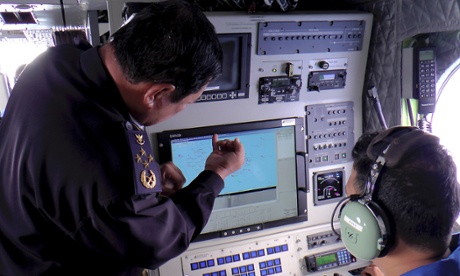
The director general of the Malaysian maritime enforcement agency, Admiral Mohd Amdan Kurish, left, checks a radar during the search for the missing plane. Photograph: AP
 Submitted by Tyler Durden on 03/14/2014 07:58 -0400


No comments:
Post a Comment